
Maps
Maps reflect the diversity of Indigenous heritage, their connection to the land, and their existence over thousands of years from coast to coast to coast. Traditional Indigenous place names exist in many Canadian territories (for example: Kanata, Ottawa etc.) These names hold historical and ongoing importance to Indigenous peoples. It should be noted that certain maps may be disrupted as many First Nations’ territories overlap each other and are not bound by provincial, territorial or federal borders. Using these maps will help you become aware of and familiar with different nations and territories so that you have the information you need to do further research.
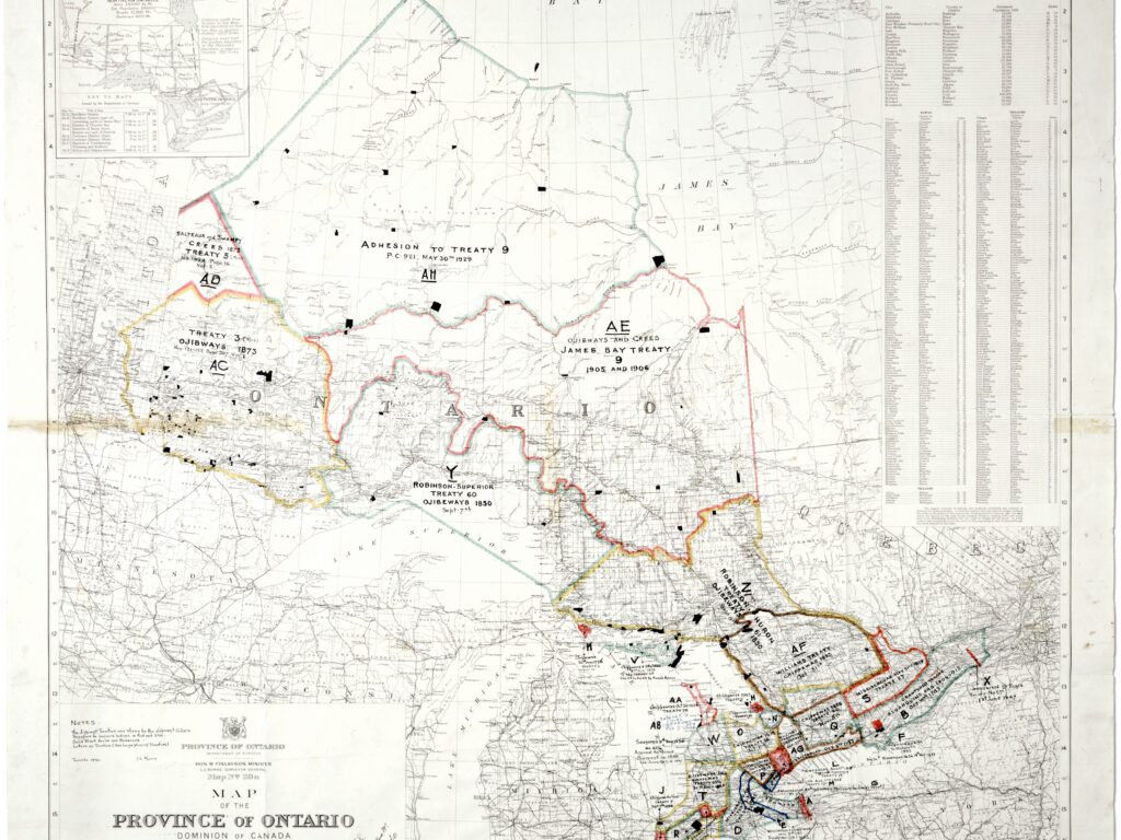
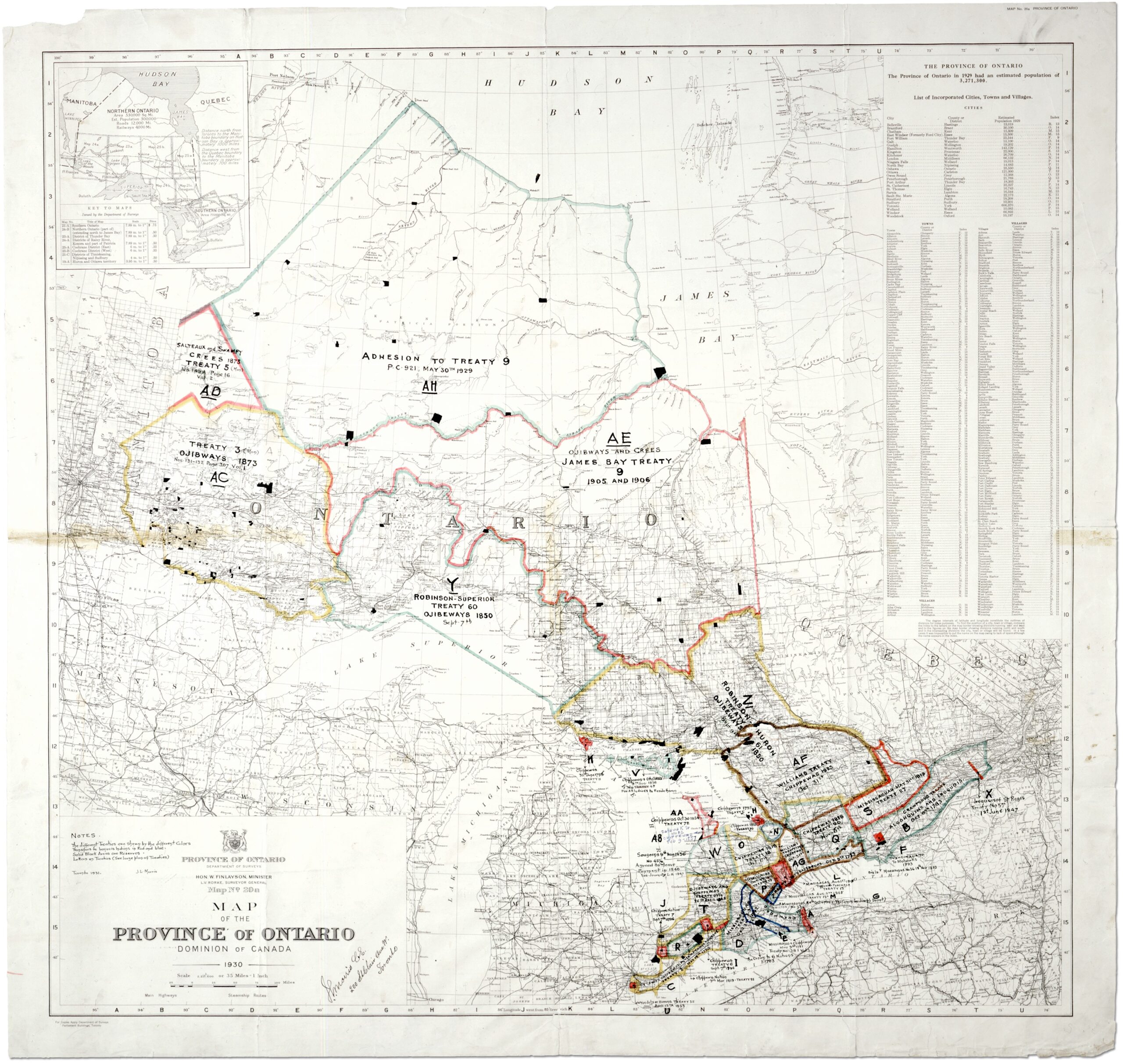
Map showing Treaties in Ontario, Dominion of Canada.
National Maps: First Nations Communities From Throughout Canada
- “Coming Home” Map (with Indigenous place names)
University of MaineThis map displays what we now know as Canada through a traditional lens, pointing out Indigenous place names in that nations’ traditional language. Certain place names also include an English translation.
- Interactive Map of Indigenous Languages, Territories and Treaties
Native LandThis interactive tool provides an overview of Indigenous territories, languages and Treaties across the globe. Other similar maps display each nation’s territories as bordering on other nations. This map, however, demonstrates that First Nations territories often overlap each other.
- Indigenous Peoples Atlas of Canada
Royal Canadian Geographic SocietyThis Atlas presents Indigenous perspectives that are much older than Canada itself through maps, artwork, history, and culture.
- First Nations Communities – Map Resources
Crown-Indigenous Relations and Northern Affairs CanadaThis website has a variety of resources including interactive maps of First Nations territories. This resource is a solid starting point.
- Map of Status Reserves
Crown-Indigenous Relations and Northern Affairs CanadaThis map displays Status Reserves as recognized by the Federal government. Maps like these display territory that has either been claimed or allocated through the Indian Act and is not reflective of understandings of traditional territory.
Map of Residential Schools Recognized Under the IRSSA
139 Residential Schools were recognized under the Indian Residential School Settlement Agreement (IRSSA). Over 1500 institutions were not recognized under the terms of this agreement.
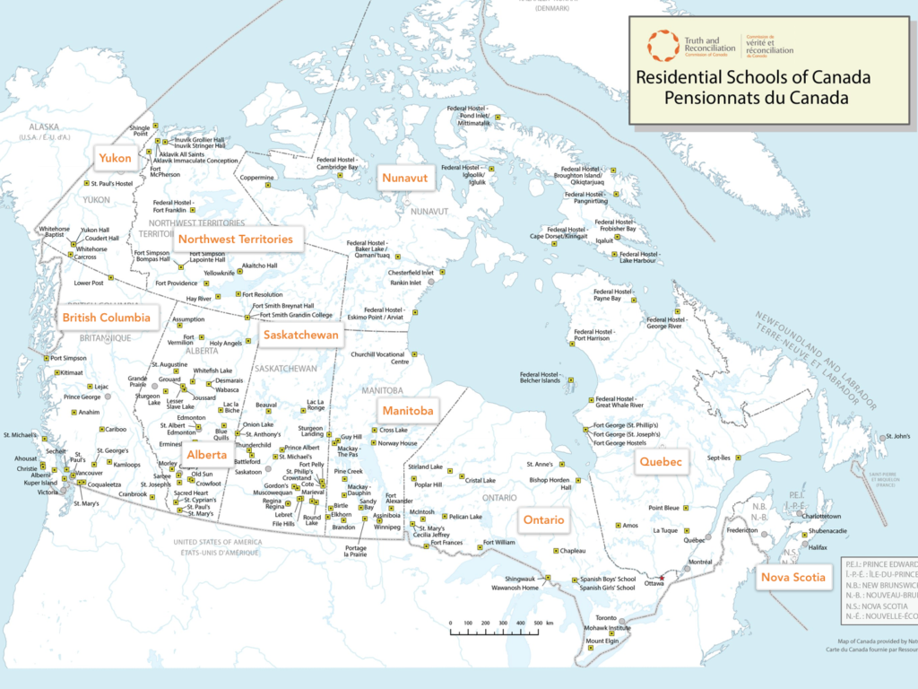
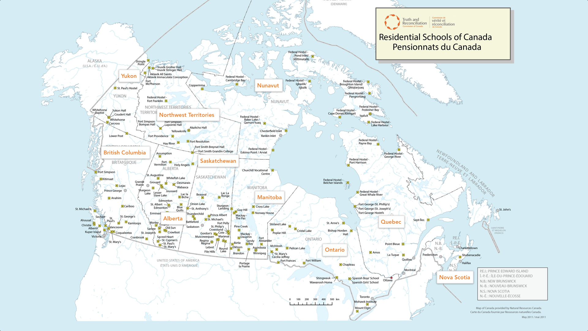
- “Did You Live Near a Residential School?” Residential School Map
CBCThis interactive map allows users to see if there was a Residential School in or near their community.
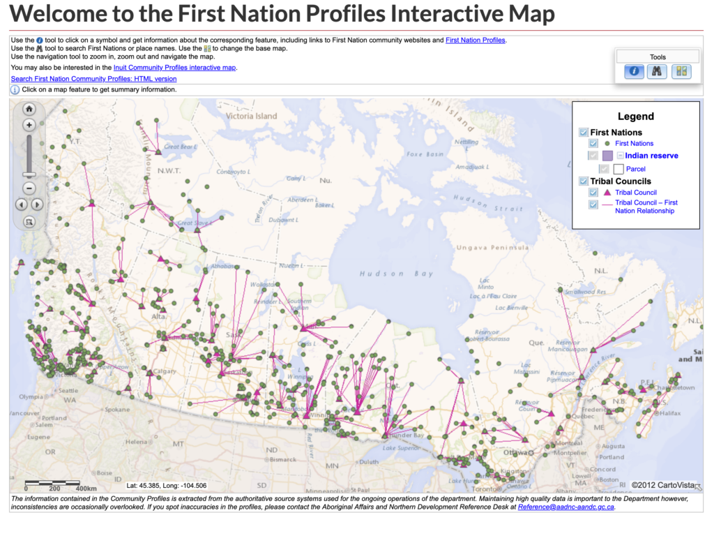
- Interactive Map (First Nations)
Crown-Indigenous Relations and Northern Affairs CanadaThis interactive map allows users to view First Nations by Indian Reserve and by Tribal Council. The pink lines demonstrate relationships between First Nations Tribal Councils.
- Student Research: First Nations Timelines and Profiles (Interactive Map)
University of Ottawa, Institute of Indigenous Research and StudiesThe University of Ottawa’s Institute of Indigenous and Canadian Studies has an online portal for student research relating to First Nations histories and profiles. The students and their professor present an interactive map with various nations’ histories.
Regional Maps: From Regions Throughout Canada
The following are regional, provincial and territorial maps. It should be noted that First Nations territories precede and transcend state borders:
- Yukon – First Nations Traditional Territories
- British Columbia – First Nations Map
- Alberta – Treaty Map – “We are All Treaty People”
- Alberta – Treaty Map – “We are All Treaty People”
This infographic displays a map of Alberta by Métis Nation of Alberta Region, and by Treaty. It includes First Nations communities and their language grouping.
- Saskatchewan – First Nations Map
- Manitoba – First Nations Map
- Manitoba – First Nations Map
- Ontario Map (Treaties and First Nations)
This map displays Ontario by Treaty Region and shows the locations of First Nations reserves.
- Quebec – First Nations Map
- New Brunswick – First Nations Communities Map
- Nova Scotia – Mi’kmaq Community Map
- Prince Edward Island- Mi’kmaq Community Map
There are limited maps available for Newfoundland and Labrador First Nations communities. First Nations communities can be found through Atlantic maps found under Crown-Indigenous Relations and Northern Affairs Canada . You may also do your own searches by community:
- Newfoundland – Miawpukek First Nation, and Qalipu First Nation
- Labrador – Mushuau Inuu First Nation, and Sheshatshiu Innu First Nation
First Nations Profiles
The First Nations Profiles is a collection of information that describes individual First Nation communities across Canada. The profiles include general information on a First Nation along with more detailed information about its reserve(s), governance, federal funding, geography, registered population statistics and various Census statistics.
These community profiles were developed by Crown-Indigenous Relations and Northern Affairs Canada as a means of making the most often requested information readily available:
First Nation Profiles Interactive Map from Crown-Indigenous Relations and Northern Affairs Canada
